| | Some benefits our UAS Photogrammetry
can offer...
| |
|
| | The SUMO UAS team led by Adam Stanford, is at the very forefront of drone surveying. With over a decade of experience, our team are authorised CAA pilots and GIS and CAD specialists.
| |
| | Most people already understand that drones capture photos and video and they would not be wrong!
However, there is much more that can be achieved with a SUMO UAS Drone Survey, which offers a cost effective, accurate and rapid method of data capture for landscapes and historic buildings.
| |
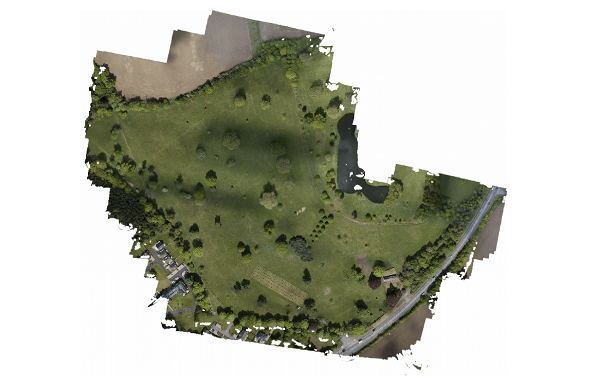
| | Above: Orthomosaic generated from UAS Photogrammetry | |
| | Commissioning a UAS photogrammetry survey will improve the understanding of a landscape, even when Lidar may be available.
UAS photogrammetry improves on the resolution (ground sampling distance) and is generally under 3cm, which means that a lot more detail is captured compared to Lidar (even over hundreds of hectares) and therefore quickly delivers a lot more detail. This offers a more comprehensive understanding of the survey area, including the possibility of archaeology being present beneath the surface, at a fraction of the cost of a conventional earthwork or topographic survey.
UAS photogrammetry is also georeferenced with GPS ground control points and is accurate to within 2cm, providing highly detailed and measurable survey results that can be further analysed to produce comprehensive and professionally written reports.
| |
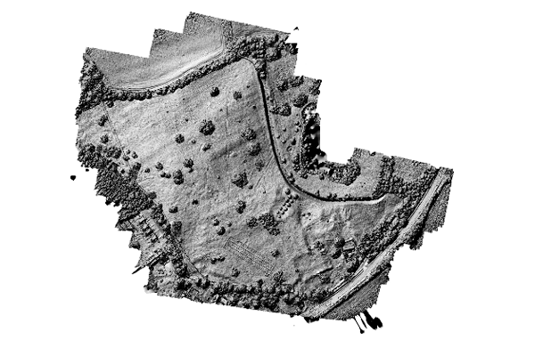
| | Above: Digital Elevation Model with hillshade, showing defined detail to the survey area. | |
| | A UAS photogrammetry survey can also cover areas that may be difficult to access, allowing safe, rapid and accurate surveying of complex and challengingly large areas, in a fraction of the time.
| |
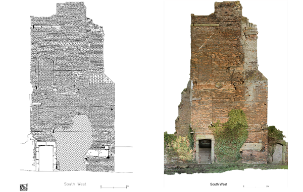
| | Above left: 2D Drawing of Photogrammetry. Above right: 3D Drawing of Photogrammetry. | |
| | The data captured from a UAS photogrammetry survey can also be used to produce plan and elevation orthorectified images and detailed ‘brick by brick’ 2D drawings of structures and buildings, plus 3D models, thereby enabling clients to get a real-life representation of any structures in the survey area.
Call the SUMO UAS team today to discuss your next project. We will gladly discuss how a UAS photogrammetry survey can deliver a cost-effective solution to your surveying needs.
| |
| | SUMO Geomatics & UAS Operations
| |
|
| | Why not check out some of the other survey services available from SUMO Geophysics? | |
| | SUMO Services is a leading National provider of UAS Drone surveying in the UK. All our Pilots are CAA Approved. SUMO Services is a member of ARPAS-UK and is a DroneSafe Registered Operator.
| |
|
|