| | Drones in Archaeology and Heritage
| |
|
| | The latest from SUMO GeoSurveys, providing a range of aerial and geospatial surveys using drones, known commercially as UAS (Unmanned Aircraft Systems).
To explore our full range of drone surveys, click here. | |
|
| | SUMO GeoSurveys is one of the UK’s leading drone providers for archaeological and heritage projects, offering high quality models and reports to aid your work programme from start to finish, all the while adding to the archaeological record.
With teams from St. Austell to Orkney, we cover every part of the UK.
| |
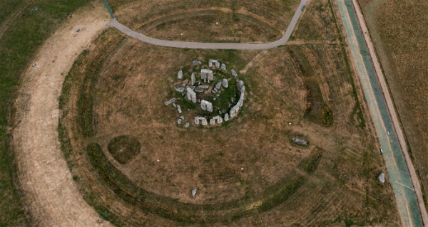
| | Above: Aerial photo from a recent SUMO drone survey at Stonehenge. | |
| | Qualified Archaeologists and Drone Pilots | |
| | SUMO GeoSurveys employs a number of university educated archaeologists, between them sharing a vast knowledge of archaeological earthworks, historic buildings, and geophysics. This comes in addition to their CAA approved drone pilots with experience of surveying archaeological and heritage assets, utilising skills in geospatial, topographic, and building recording.
With a large team and high value of appropriate insurance, we can offer a reliable and proficient service to ensure that your project is in safe hands. | |
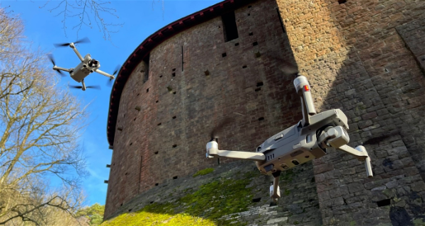
| | Above: Drones in operation recording an historic building. | |
| | Digital Drone Deliverables | |
| | The versatility of drone surveying equates to a range of utilities and outputs which will contribute to your project, be it part of a planning application, historical assessment, restoration project, or research dig.
| |
| | Example 1:Orthophoto(landscape and earthwork recording). | | 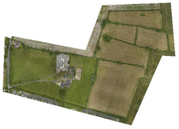 | |
|
| | 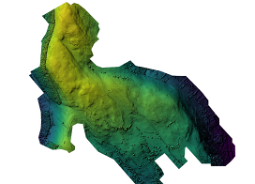 | | Example 2:
DEM(Digital Elevation Model) for GIS analysis. | |
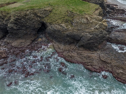
| | Example 3:Multispectral Surveysfor sub-surface investigations. | | 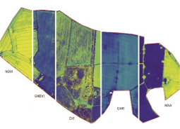 | |
|
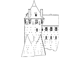
| | 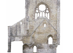 | | Example 4:Orthographic Elevationfor historic building recording | |
| | Example 5:Excavation Recording(pre-, mid- & post-ex surveying for ongoing progress monitoring). | | 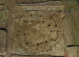 | |
|
| | 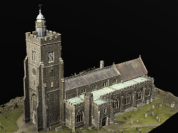 | | Example 6:3D Modellingfor recorded and restoration projects (can be combined with a detailed Measured Building Survey). | |
| | Example 7:Setting Surveysgeneral photography and video. | | 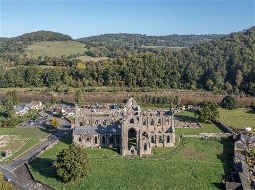 | |
|
| |  | | Example 8:Archaeological Recording
for inaccessible locations. | |
| | Example 9:Line Drawings
| |  | |
|
| | 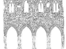 | | Example 10:Stone-by-Stone Illustrations
| |
| | Example 11:Interpretive ReportsReports (including GIS analysis of topographic, micro-topographic, multispectral data, and other available sources). | | 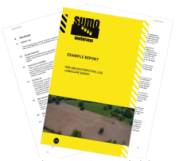 | |
|
| | 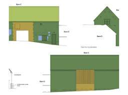 | | Example 12:Historic Building Reports
| |
| | Example 13:Combined with Geophysics
(UAS-derived interpretation combined with magnetometry). | | 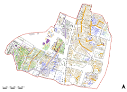 | |
|
| |  | | Example 14:Volumetric Analysis
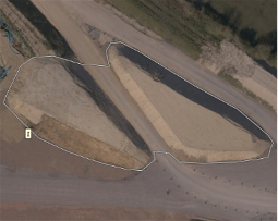
(for spoil heaps and excavations). | |
| | Please pick up the phone and speak to
Simon Batsman on
| |
|
| | Click to Join Our Upcoming Webinar... | |
| | Elevating Surveying: Unlocking the Power of Drones for Efficiency and Innovation | |
| | 27th March at 12.00 pm (duration 45 mins). | |
|
| | Why not check out all the survey services available from SUMO?
| |
| | AERIAL SURVEYS
| | ARCHAEOLOGICAL
SURVEYS
| | GEOPHYSICAL
ENGINEERING
| | LASER SCANNING
& 3D | |
| | MEASURED BUILDING | | RAIL
SURVEYS
| | TOPOGRAPHIC SURVEYS
| | UTILITY
SURVEYS
| |
| | The SUMO Group is a multi-disciplinary survey business committed to maintaining the highest possible standards in all aspects of surveying. Whatever service you use, we pride ourselves on providing a survey that you can truly rely on.
| |
|
| | Interested in selling your survey business to SUMO? | |
|
| | Download our E-Brochure to find out how else we can help. | |
|
|