| | The latest from SUMO GeoSurveys, providing a range of aerial and geospatial surveys using drones, known commercially as UAS (Unmanned Aircraft Systems). | |
|
| | See how SUMO GeoSurveys’ elite range of drone surveys can help kickstart your project in the new year.
| |
| | From pre-phase topographic surveys through to progress monitoring and post-phase inspections, we are committed to offering you a cost-effective, time-efficient and highly accurate methodology, tailored to your work programme.
| |
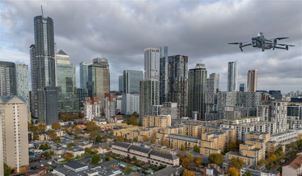
| | Above: UAS operation in Central London. | |
| | Qualified, Experienced & Insured | |
| | Our aerial surveyors are CAA (Civil Aviation Authority) certified remote pilots with years of experience, operating a variety of different aircraft across a spectrum of sites. Every job is meticulously planned, including the essential review of the airspace and the production of a Risk Assessment to ensure we adhere to legal procedures.
The safety of members of the public is paramount during all operations. Take-off-and-landing locations, operating altitudes, and assessing nearby hazards are all taken into consideration, and all SUMO surveys are covered by a high value of appropriate insurance.
| |
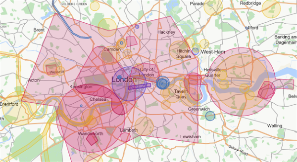
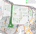
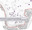
| | Above: Aeronautical chart displaying restricted airspace zones in London. These charts form part SUMO GeoSurveys’ Risk Assessments. | |
| | Wide Range of Drone Surveys | |
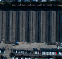
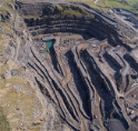
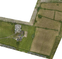
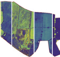
| | Topographic Surveys | | Point
Clouds | | Solar Farm Surveys | |
| | Roof
Inspections
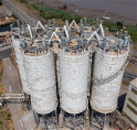
| | Asset
Inspections | | Volumetric Analysis | |
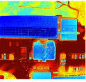
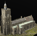
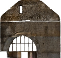
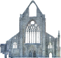
| | Thermographic Surveys | | Building Recording (3D Modelling) | | Landscape Surveys | |
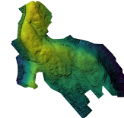
| | DEMs (Digital Elevation Models) | | Multispectral | | Archaeology | |
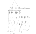
| | Internal Photogrammetry | | Orthographic Elevations | | Stone-by-Stone Illustrations | |
| | Line Drawings | | Interpretive Reports | | Detailed
Figures | |
| | Historic Building Reports | | Water Leak Detection
| | Solution Feature Investigation
| |
| | Please pick up the phone and speak to
Simon Batsman on
| |
|
| | Why not check out all the survey services available from SUMO?
| |
| | AERIAL SURVEYS
| | ARCHAEOLOGICAL
SURVEYS
| | GEOPHYSICAL
ENGINEERING
| | LASER SCANNING
& 3D | |
| | MEASURED BUILDING | | RAIL
SURVEYS
| | TOPOGRAPHIC SURVEYS
| | UTILITY
SURVEYS
| |
| | The SUMO Group is a multi-disciplinary survey business committed to maintaining the highest possible standards in all aspects of surveying. Whatever service you use, we pride ourselves on providing a survey that you can truly rely on.
| |
|
| | Interested in selling your survey business to SUMO? | |
|
| | Download our E-Brochure to find out how else we can help. | |
|
|