| | Issue No.12
Interior Photography and Photogrammetry
| |
|
| | The latest from SUMO GeoSurveys, providing a range of aerial and geospatial surveys using drones, known commercially as UAS (Unmanned Aircraft Systems). | |
|
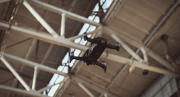
| | Photogrammetry: the insider's view! | |
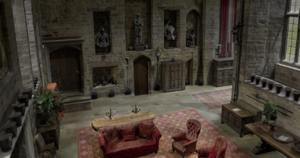
| | Transform the way you view large spaces with our interior photography and photogrammetry surveying services, driven by advanced drone technology.
| |
| | Our drones capture every angle and detail producing high-quality images that go beyond traditional surveying.
| |
| | Whether you’re an architect, designer, or property manager, our drone photogrammetry offers detailed visualisations that allow for the development of 3D building models.
This makes planning, documentation and design easier and more impactful than ever.
Experience a smarter way to survey interiors - opt for our drone survey solutions and benefit from the enhanced clarity at any height!
| |
| | Please pick up the phone and speak to
Simon Batsman on
| |
|
| | Why not check out all the survey services available from SUMO?
| |
| | AERIAL SURVEYS
| | ARCHAEOLOGICAL
SURVEYS
| | GEOPHYSICAL
ENGINEERING
| | LASER SCANNING
& 3D | |
| | MEASURED BUILDING | | RAIL
SURVEYS
| | TOPOGRAPHIC SURVEYS
| | UTILITY
SURVEYS
| |
| | The SUMO Group is a multi-disciplinary survey business committed to maintaining the highest possible standards in all aspects of surveying. Whatever service you use, we pride ourselves on providing a survey that you can truly rely on.
| |
|
| | Interested in selling your survey business to SUMO? | |
|
| | Download our E-Brochure to find out how else we can help. | |
|
|