| | Issue No.8
Multispectral Surveys
| |
|
| | The latest from SUMO GeoSurveys, providing a range of aerial and geospatial surveys using drones, known commercially as UAS (Unmanned Aircraft Systems). | |
|
| | One Survey; Multiple Rewards! | |
| | UAS Multispectral Surveys have the capacity to detect sub-surface features with archaeological potential, even on sites hidden beneath crops.
With the crop season approaching, now is the perfect time to book a Multispectral Survey for your archaeological assessment.
| |
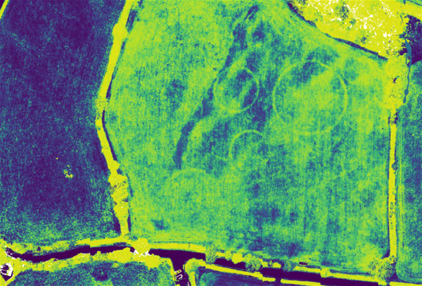
| | Figure 1: Example multispectral output with Green Ratio Vegetation Index [GRVI] transformation, identifying ring ditches hidden beneath the surface. | |
| | UAS Multispectral Surveys have the ability to identify sub-surface archaeology via the overlying vegetation. With the capability to survey 100+ hectares in a single day and over landscapes restricted by vegetation - in particular, crops - Multispectral Surveys can greatly inform archaeological assessments, quickly and cost-effectively.
This method can be used to complement geophysical surveys, and even serve as an alternative option when crops inhibit access on to site.
| |
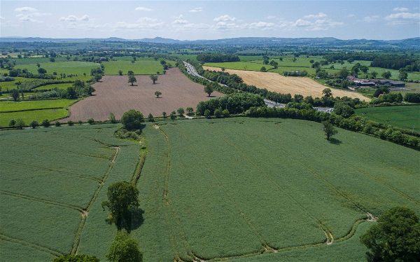
| | Figure 2: Dense crop preventing geophysics ahead of a multispectral survey. | |
| | A series of raster transformations can be performed using GIS, and interpreted in a detailed report to discuss the findings. Our analysis of the various index models provide a greater scope to identifying sub-surface features. We also conduct an RGB earthwork survey simultaneously to the multispectral to provide base mapping and a richer understanding of the site.
| |
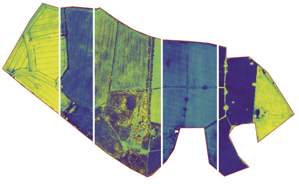
| | Figure 3: Various multispectral raster transformations. | |
| | Please pick up the phone and speak to
Simon Batsman on
| |
|
| | Why not check out all the survey services available from SUMO?
| |
| | AERIAL SURVEYS
| | ARCHAEOLOGICAL
SURVEYS
| | GEOPHYSICAL
ENGINEERING
| | LASER SCANNING
& 3D | |
| | MEASURED BUILDING | | RAIL
SURVEYS
| | TOPOGRAPHIC SURVEYS
| | UTILITY
SURVEYS
| |
| | The SUMO Group is a multi-disciplinary survey business committed to maintaining the highest possible standards in all aspects of surveying. Whatever service you use, we pride ourselves on providing a survey that you can truly rely on.
| |
|
| | Interested in selling your survey business to SUMO? | |
|
| | Download our E-Brochure to find out how else we can help. | |
|
|